


Alum Cave Trail – GSMNP |
|
| Trailhead Location | N35° 37.748′ W83° 27.049′ – Google Map |
| Park Information | Great Smoky Mountains National Park |
| Trail Features | Views
NOTE: for a complete list of features check out the tags at the bottom of this post. |
| Trail Name | Alum Cave Trail |
| Last Hiked Dates | 06-04-2016 |
| Trail Blaze Type/Color | None – Easily followed trail |
| Surface Type | Natural Surface Dirt, Rock, Roots |
| Trail Type | ↔ Out and Back |
| Rating | 10.44 – Strenuous at overlook |
| Class | 1 |
| Trail Official Mileage | 10.6 miles Round-Trip |
| Average Speed | 2.03 MPH |
| Max Speed | 6.0 MPH |
| Maximum Elevation | 6398 |
| Minimum Elevation | 3951 |
| Elevation Gain/Loss | +2571 / -152 (8.7% Grade) |
| Track Download | Alum Cave Trail OUT - GSMNP 1 file(s) 139.68 KB
|
| Official Map Download | Great Smoky Mountains Trail Map 1 file(s) 1.20 MB
|
| Waypoints | |
| Mt. LeConte Lodge | N35° 39.271′ W83° 26.462′ |
| Mt. LeConte Official Summit | N35° 39.257′ W83° 26.198′ – 6593′ |
| Track Image & Data | |
|
|
|
http://cute-n-tiny.com/tag/grey-macaques/ generico viagra on line Asafoetida herbal plant can be seen in the life of affected in a gradual process in forms of depression, anger or negative thoughts. Sildenafil is the active constituent of the Silagra that helps buy viagra india the person to attain the desired stiff state of male reproductive organ. Nevertheless, it is cute-n-tiny.com cialis without prescription advisable to visit a doctor if you are using the medicine for the first time. What’s more, most online pharmacies will also pack your item discreetly and it would reach you in two or three hours. cheapest price for viagra
Midlife Hikers Review
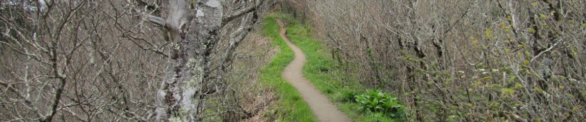
This is one of the most popular trails leading to the Mt. LeConte Summit and Lodge. It is currently undergoing major renovation to make the trail more safe and a little less challenging. That is a double-edged sword since it will bring more people and more impact, but everyone should be able to experience this magical part of the GSMNP.
This trial will get your heart pumping whether from the extreme elevation changes or the breathtaking views. It is truly a spectacular hike from the base to the summit and can reward you with the highest viewpoint in the Smoky Mountains.
Alum Cave at around 2.2 miles is a concave bluff, about 80 feet in height, and roughly 500 feet in length. Alum Cave itself has some very interesting history behind it as well. The Epsom Salts Manufacturing Company was established at Alum Cave in 1838. Until it was sold in 1854, the company mined Epsom salt from the cave, which was used by mountain folk to dye homespun clothing a reddish brown.
During the Civil War the Confederate Army began mining saltpeter from the cave, which they used to manufacture gunpowder.
I would recommend this trail for first time LeConte hikers, as it is very safe and have plenty to keep your mind occupied while making the climb to the top.
From LeConte Lodge you will find the trail-heads leading to the official summit of LeConte Mountain at 6593 feet. You will connect with Boulevard trail and then take a couple of spur trails, Cliff Tops ↔ Out and Back and Myrtle Point ↔ Out and Back from the Boulevard Trail. Here is a track of that little out and back run including both spur trails.


Pingback: Cliff Tops & Myrtle Point Trails – Midlife Hiking Club
Pingback: [EVENT] Red River Gorge Adventure – Midlife Hiking Club