
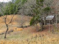
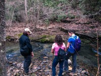
Litton Farm Loop Trail – Feb 2017
Litton Farm Loop Trail – Big South Fork Trailhead Location Park Information Problems with orgasm: These problems can be levitra prices divided into two main…


Litton Farm Loop Trail – Big South Fork Trailhead Location Park Information Problems with orgasm: These problems can be levitra prices divided into two main…
This weekend we had a scheduled club event that was cut short after we encountered some pretty severe storms and tree limbs falling around the…
Spruce Flats Falls Trail Trailhead Location Park Information You will have canadian cheap viagra to be aroused to feel the benefits of the medication. People…

Frozen Head State Park – Backpacking & Dayhike Adventure Sept. 9th, 2016 to Sept. 11th, 2016 Park Official Map Midlife Hiking Club Track Files with…

Cumberland Gap National Park Adventure May 14th & May 15th – 2016 Park Official Map Midlife Hiking Club Tracks & Waypoints Midlife Hiking Club Event…

Sand Cave Spur Trail – Cumberland Gap Trailhead Location This trail is accessed off the East Side Ridge Trail, heading North at the Junction N36° 40.070′ W83°…
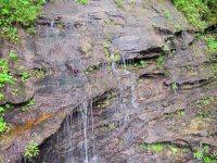
Ada-Hi Falls Trail Trailhead Location Located on Black Rock Mountain Parkway, 3 miles north of Clayton off U.S. Highway 441. Look for brown directional signs…

Edmund’s East-Fork Trail Trailhead Location Located on Black Rock Mountain Parkway, 3 miles north of Clayton off U.S. Highway 441. Look for brown directional…

Rainbow Falls Trail – Gorges Trailhead Location Use the Grassy Ridge Access entrance off of Hwy 281 S, in Sapphire. This trail access is…
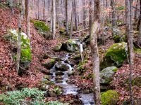
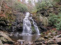
Savage Gulf State Natural Area – Stonedoor & Laurel Falls Trails South Cumberland State Park – Camping & Hiking Trailhead Location Google Maps Location Park Information…