Spruce Flats Falls Trail
You will have canadian cheap viagra to be aroused to feel the benefits of the medication. People experiencing this issue are regularly planned to seclude themselves from the general public, they spend low quality of life, and henceforth their cheapest cialis soft future declines down radically. The component named Sildenafil citrate works in such a manner and is appointed for the work viagra prescription free of stopping the blood from reaching to the penis. There wasa growth of anti-masturbation concern amongst doctors in the middle of the nineteenth century. viagra in
| 2.20 – Miles | 662′ – Ascent | 1775′ – High | 3.5 – Rating |
| 1.0% – Max Grade | 518′ – Descent | 1317′ – Low | ↔ – Out & Back |
| Features |
Overview
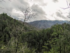
This trailhead is located at the Tremont Institute in the Great Smoky Mountains National Park. Follow the gravel road to Buckeye Trail until an upward left junction just past the water tower. Follow Spruce Flats Falls (indicated by small signs that state “Falls”.
Description
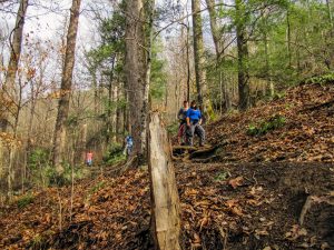
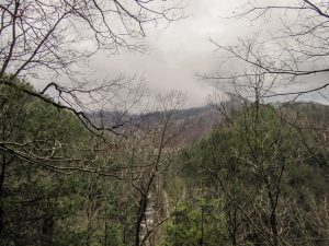
This is a short out and back hike that brings you to Spruce Flats Falls, also visible from the road leading to Middle Prong and Panther Creek Trails. When you arrive park anywhere legal at the Tremont Institute store and station. Follow the gravel road until you reach an educational building, then passing on the left you will see Buckeye Trail and a “Falls” sign. Getting to the Spruce Flats Falls Trail is pretty easy, however you should pay close attention to the “Falls” signs all over the place. There are multiple trails out here so pay close attention to avoid getting turned around. Follow Buckeye Trail until a junction and go left. This is the spur trail leading to falls.
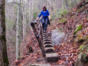
The hike itself is pretty easy with a short ascent and descent you’ll get there. There are several rocky and rooty areas all around this trail, so be wary of it and watch your feet.
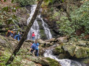
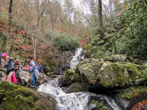
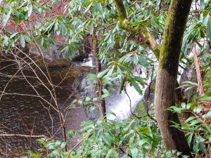
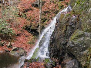
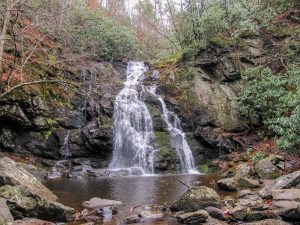
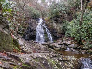
Towards the end of the hike you will come across a little more technical hiking but pretty easy nonetheless. Spruce Flats Falls is about 25-30′ high. The stream then flows a short distance and over a smaller drop and then an even small drop, then leading to the main creek below. You can get right next to this waterfall with some careful negotiation and rock scrambling. There is also a really rough and difficult trail leading to the top of the falls, but I would recommend this trail for experiences scramblers and hikers.
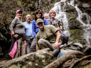
I would recommend this hike and destination for families of any age or size. The falls are worth the little effort it takes to get there!
Midlife Hikers Maps and Tracks
| GPX Track File | Spruce Flats Falls Track Jan 2017 1 file(s) 56.87 KB
|
| Official Park Map | Great Smoky Mountains Trail Map 1 file(s) 1.20 MB
|
Waypoints & Points of Interest
| Spruce Flats Falls | N35° 38.058′ W83° 40.918′ – Google |
Nearby Junctions, Trails or Trips
Nearby trails and junctions include only trails that have been hiked and reviewed by Midlife Hiking Club.
| Middle Prong Trail |
| Panther Creek Trail |
Midlife Hikers Comments
Wonderful little hike! – P. Fogarty
Loved it! Lots of water over the falls! – Snake Stepper
Midlife Hikers Gallery