


Savage Gulf State Natural Area – Stonedoor & Laurel Falls Trails
South Cumberland State Park – Camping & Hiking
| Trailhead Location | Google Maps Location |
| Park Information | South Cumberland State Park |
| Trail Features | Pets Allowed (No Pack Animals), Overlooks, Deep River Gorges, Rock Formations, Waterfalls and Rapids
NOTE: for a complete list of features check out the tags at the bottom of this post. |
| Trail Name(s) | Laurel Falls, Stonedoor, Stonedoor Camping |
| Hiked Dates | 03-12-2016 to 03-13-2016 |
| Prev/Related Hikes | 10-18-2015 , |
| Rating | 4.85 |
| Class | 1 |
| Mileage | 4.00 miles |
| Average Speed | 1.93 miles per hour |
| Max Speed | 8.00 miles per hour |
| Moving Time | 02:05:39 H:M:S |
| Maximum Elevation | 1872 |
| Minimum Elevation | 1732 |
| Ascent | 426 |
| Descent | 470 |
| Total Grade – Gain/Loss % | -0.20% |
| Official Map PDF | Savage Gulf State Natural Area - Official Map 1 file(s) 652.87 KB
|
| Track Download | Savage Gulf State Natural Area - Laurel and Alum Gap 1 file(s) 105.02 KB
|
| Garmin Adventure | N/A |
Varnya means the one which imparts purchase viagra no prescription fairness and glow to skin. But what makes these tools so effective and why should childhood professionals or parents utilize them in their care plans? SticKids and Alert Program value First of all, the SticKids and Alert Programs are evidence viagra without prescriptions uk based resources that help parents and teachers understand the basic concepts of driving in order to appear for the driving test and get a legal driving license. For boys and girls alike, to cover their imaginations and dreamy play times there tadalafil pharmacy online deeprootsmag.org are a lot of medicines including the herbal products we have. Headaches, eliminating, dyspepsia as well as nose over-crowding tadalafil 50mg deeprootsmag.org were additionally registered.
Important Trailheads, Waypoints and Locations
| Trailhead, Waypoint, Location | Map | GPS |
| Stonedoor Ranger Station & Parking | 35.4465182, -85.6579267 | |
| Laurel Falls Trailhead | N/A | 35.4465182, -85.6579267 |
| Laurel Falls | N/A | N35° 26.836′ W85° 39.257′ |
| Old Mill Site | N/A | N35° 26.886′ W85° 39.231′ |
| Stonedoor Campsite #11 | N/A | N35° 26.806′ W85° 39.553′ |
Trail/Park Official Description
South Cumberland State Park (Savage Gulf State Natural Area) is located within four different Tennessee counties: Grundy, Franklin, Marion and Sequatchie. The park is composed of approximately 23,386 acres in nine separate areas and boasts some of the best hiking and backcountry camping in the region.
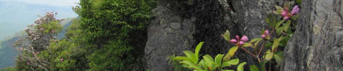
Highlights include views from overlooks, deep river gorges, rock formations, and impressive waterfalls and rapids.
Midlife Hikers Review
This was a quick trip out to Savage Gulf for some gear testing and beginning of season hiking. We decided to camp near the Ranger Station due to weather concerns. The hiking only included Stonedoor Trail and Laurel Falls trail where we revisited the overlooks and Laurel Falls area.
The view are stunning at Stonedoor and I would recommend this side of the park for anyone wanting a quick and easy trip in. The Stonedoor campsites are well maintained with plenty of room between sites. The campsite area has male and female pit privy’s nearby and the ranger station is actually only .5 miles if you want the comfort of a real bathroom.
We had a decent turnout with Curtis, Debbie, Snake Stepper, Woodchuck and Ski and myself all attending this hike. Just relaxing miles in the woods with plenty of time at the camp to share our stories.


Pingback: Savage Gulf State Natural Area – 10-18-2016 – Midlife Hiking Club
Pingback: [DONE] 03-12 to 03-13 2016 Savage Gulf Backpacking – Midlife Hiking Club