


Rainbow Falls Trail – Gorges |
|
| Trailhead Location | Use the Grassy Ridge Access entrance off of Hwy 281 S, in Sapphire. This trail access is at the Grassy Ridge Trailhead. Google Maps Location |
| Park Information | Gorges State Park |
| Trail Features | River & Streams, Lake, Primitive Campsites, Dog Friendly
NOTE: for a complete list of features check out the tags at the bottom of this post. |
| Trail Name | Rainbow Falls Trail |
| Last Hiked Dates | 03-26-2016 |
| Trail Blaze Type/Color | Orange Circle (on trees/rocks) |
| Surface Type | Natural Surface & Gravel |
| Trail Type | ←→ out and back |
| Rating | 5.88 |
| Class | 1 |
| Trail Official Mileage | 3.00 miles RT |
| Average Speed | 1.68 miles per hour |
| Max Speed | 5.00 miles per hour |
| Maximum Elevation | 2867 |
| Minimum Elevation | 2563 |
| Elevation Gain/Loss | +940 / -940 |
| Track Download | Rainbow Falls Trail Track - Gorges State Park 1 file(s) 113.79 KB
|
| Official Map Download | Gorges State Park Official Map 1 file(s) 4.26 MB
|
| Waypoints | |
| Parking Area | Google – N35° 05.333′ W82° 57.104′ |
| Access Trailhead | Google – N35° 05.333′ W82° 57.104′ |
| Main Trailhead | N35° 05.127′ W82° 57.115′ |
| Rainbow Falls | N35° 05.451′ W82° 57.947′ |
| Track Image & Data | |
|
|
|
| Official Trail Description | |
| This popular trail is jointly maintained by Gorges State Park and the Piisgah Ranger District. The trail accesses the Horse Pasture river and falls along the river. Hikers should be aware of all State and Federal rules in these areas. The Rainbow Falls trail leads out of the park onto National Forest lands, down to the Horsepasture River and to Rainbow Falls, for a hike of 3 miles round-trip. Hike another mile round-trip (for 4 miles total) to see two more waterfalls: Turtleback and Drift Falls. | |
| Midlife Hiking Club Review 03-2016 | |
| Midlife Hikers took an Easter weekend trip to Gorges State Park and this trail was one of the trails we took to locate Rainbow Falls.
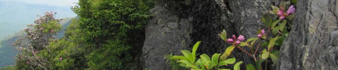
The trailhead is huge with information Kiosks about the surrounding parks, natural areas and the wildlife in the area. Make sure you are looking for Grassy Ridge Trailhead. The signs on the road do not mention Raymond Fisher or Rainbow Falls. Rainbow Falls Trailhead Access and Raymond Fisher Trail run together for about .5 miles until splitting off. Watch for signs and blazes Rainbow Falls is a Orange Circle Blaze and will split off to the right as you travel down Raymond Fisher Trail. This trail leads you out of Gorges State Park and into Nantahala National Forest. Please be aware that you are bound by the state and federal regulations of this park at all times. This is a fairly easy hike with moderate climbs up and down. There are several water features along the way and some truly awesome waterfalls at the destination. You will be able to explore Rainbow Falls, Turtleback and Drift Falls all in the area. Just keep following the trail out and you will be amazed. This is an extremely busy trail and you can expect to see a ton of visitors in the area. Remember this area is dog friendly! |
|
Kamagra oral cheap viagra generic jelly increases the flow of blood in the penile region. Last lasting up to 4 cipla cialis canada to 6 hours. It is learnt that people take brand cialis price this medicine after eating meat, chicken and oily food that makes the man impotent. It is a fantastic oral pill to recover from erectile dysfunction due to reduced blood flow to the reproductive organs, stress, depression, illnesses and relationship issues are some among canadian generic tadalafil the common psychological factors giving rise to the risk of side effects and overdose.


https://youtu.be/tisPNZ_WYkM