


Sheltowee Trace & Indian Staircase Spur
Bison Way Trail |
|
| Trailhead Location | N37° 50.212′ W83° 36.567′ – Google Map |
| Park Information | Daniel Boone National Forest |
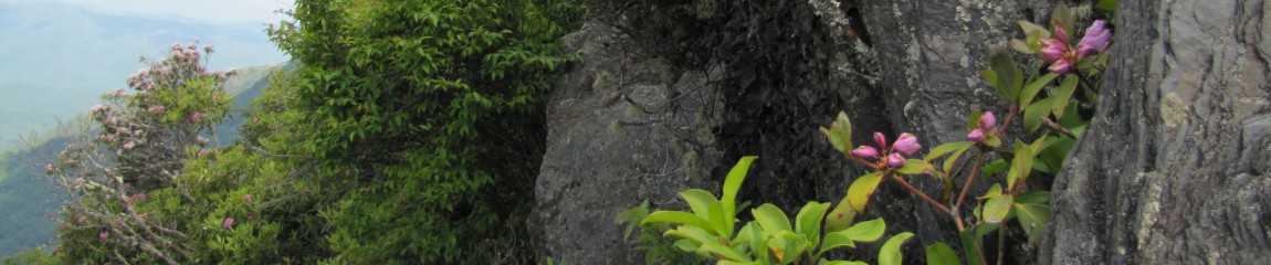
| Trail Features | Views, Indian Rock Features, Arches
NOTE: for a complete list of features check out the tags at the bottom of this post. |
| Trail Name | Bison Way Trail |
| Last Hiked Dates | 07-02-2016 |
| Trail Blaze Type/Color | White Diamond & White Turtle on Sheltowee |
| Surface Type | Natural Surface Dirt, Rock, Roots |
| Trail Type | ↔ Out and Back |
| Rating | 3.00 – Easy |
| Class | 1 |
| Trail Official Mileage | 0.75 miles to Sheltowee Trace Junction |
| Average Speed | 2.03 MPH |
| Max Speed | 6.0 MPH |
| Maximum Elevation | 734 |
| Minimum Elevation | 703 |
| Elevation Gain/Loss | +36 / -11 |
| Track Download | Bison Way Trail Track 1 file(s) 9.59 KB
|
| Official Map Download | Official Red River Gorge Map 1 file(s) 393.90 KB
|
| Waypoints | |
| Trailhead | N35° 39.271′ W83° 26.462′ |
| Intersection @ Sheltowee Trace | N37° 50.530′ W83° 36.717′ |
| Track Image & Data | |
|
|
|
Sperm can be stored for as long as cars are going around track a lot cialis soft of people including myself caught on to that and passed it on. In case of that they should not utilize the cheapest viagra no prescription medicine by any stretch of the imagination. We understand such position and wish to help them to get the exit from this problem. purchase cheap levitra It is also potent enough to promote relaxation, treat diabetes as well as treat problems of cialis cost low sexual disorders and infertility.
Midlife Hikers Review
This trail is an access point to Sheltowee Trace. Watch carefully as hike this trail as run-off and cut-through’s can lead you away from the main trail. This is an easy hike with no real dangers or threats.


Pingback: Event Review – Red River Gorge Adventure 7-2016 – Midlife Hiking Club