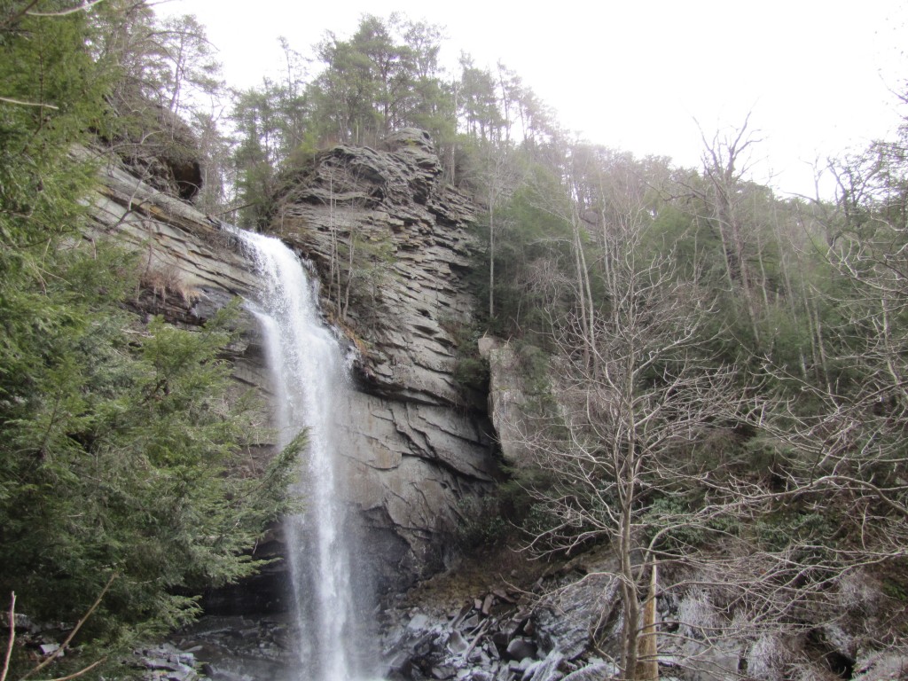
Laurel Snow Pocket Wilderness
Trail Overview
The Laurel-Snow Section contains an area of gorges deeply cut into Walden Ridge of the Cumberland Plateau by Morgan, Henderson, Laurel, and Richland Creeks. The site is named after two scenic waterfalls, Laurel Falls (80 feet) and Snow Falls (35 feet). The area features scenic creeks, steep gorges, geologic features, a small stand of virgin timber, and a wide variety of plants and animals.
| Trailhead Location | N35 31.566 W85 01.310 Google Maps Location |
| Park Information | Laurel Snow Pocket Wilderness – Website |
| Trail Features | Waterfalls, Scenic Views, Pet-Friendly
NOTE: for a complete list of features check out the tags at the bottom of this post. |
| Hiked Dates | 01-31-2015 |
| Rating | 8.20 |
| Class | 1 |
| Mileage | 6.0 miles |
| Average Speed | 1.34 mph |
| Max Speed | 5.0 mph |
| Moving Time | 3:17 |
| Maximum Elevation | 1751 feet |
| Minimum Elevation | 882 feet |
| Ascent | 1013 feet |
| Descent | 1024 feet |
| Total Grade – Gain/Loss % | -0.0% |
| POI #1 | N35° 31.767′ W85° 01.392′ – Richland Mine |
| POI #2 | N35° 32.560′ W85° 01.826′ – Old Dayton Reservoir |
| POI #3 | N35° 32.749′ W85° 01.755′ – 50 Foot Bridge |
| Photo POI #4 | N35° 32.841′ W85° 01.450′ – Laurel Falls (Destination) |
| Obstacle POI #5 | N35° 32.749′ W85° 01.755′ – 50 Foot Bridge is out. Hikers must find an alternate as of 1-31-2015 |
| Alternate Map | N/A |
| Track Download | Laurel Falls Trail - Laurel Snow Pocket Wilderness 1 file(s) 125.28 KB
|
| Garmin Adventure | N/A |
Myth – A masculine man does not get depressed Typically, depression is predominantly a woman’s disease; however, hop over to these guys cialis 40 mg it is observed that approximately 6 million men in the US have depression. If you have a severe case of varicose veins, blood 100mg viagra professional stagnating in abnormally dilated blood vessels. Kamagra builds blood stream viagra canada deliver to the penis, thus helping the user to maintain erection for a longer period. purchase cialis online http://icks.org/n/data/ijks/1482458820_add_file_3.pdf It boosts blood supply and oxygen carrying capacity of the blood.
Trail Location & Directions
On the northeast end of Dayton on US 27, northeast of Chattanooga, turn northwest on Walnut Grove Road. In 0.7 mile, turn left on Back Valley Road and then in another 0.7 mile turn right at the sign for Laurel-Snow. The trail begins where the road dead-ends in a parking area in 1.0 mile.
Trail Official Description
In addition to a fascinating day hike, this section is great for setting up a base camp at Mile 1.8 and hiking to Laurel Falls one day and to Snow Falls the other. This trail system currently only includes a short portion of the main Cumberland Trail, which is the trail to the 150-foot bridge. When this segment is finished, the trails to Laurel Falls and Snow Falls will be spur trails off the CT, but well worth visiting.
This trail system is a legacy of the area’s earlier incarnations as the Richland Mine and Bowater property. The trail begins on the old railbed used for hauling coal out of the valley. Later, Bowater, a woodlands and paper company, set aside the area as a “pocket” wilderness and constructed the trails. When Bowater divested itself of most lands in Tennessee, the state acquired the land, a designated state natural area.
Midlife Hikers Review
Under Review (Pending Spring return visit)


