
Chimney Tops Trail 2015
Trail Overview
The Chimney Tops Trail is one of the most popular hikes along Newfound Gap Road. The trail owes much of its popularity to its relatively short length, and its outstanding panoramic views from the pinnacles. Its length, less than 2 miles, however, makes for a very steep hike – so much so that many hikers don’t even reach the top. The first half of the trail is relatively tame. However, to reach the summit, hikers have to climb more than 960 feet over the course of the last mile! This is similar to the rate of elevation gain you’ll find on some of the 14,000-foot peaks in Colorado. Overview from Hiking In The Smoky’s!
| Trailhead Location | Google Maps Location |
| Park Information | Great Smoky Mountains National Park – Website |
| Trail Features | Waterfalls, Scenic Views, NO PETS ALLOWED
NOTE: for a complete list of features check out the tags at the bottom of this post. |
| Hiked Dates | 06-07-2015 |
| Rating | 6.77 |
| Class | 2 (at the tops) |
| Mileage | 3.8 miles |
| Average Speed | 1.85 mph |
| Max Speed | 8 mph |
| Moving Time | N/A |
| Maximum Elevation | 4753 feet |
| Minimum Elevation | N/A |
| Ascent | 1487 feet |
| Descent | 0 feet |
| Total Grade – Gain/Loss % | N/A |
| Official Map PDF | N/A |
| Track Download | N/A |
| Garmin Adventure | N/A |
You must say it with complete certainty that the work has orden viagra viagra been done. Sexual Desire Booster Coffee Online is available to you, so you can relax in a way if you are bothered by the ED problem. cheap viagra Visit This Link Apart from using this herbal pill view description levitra without prescription daily two times for three to four months. This issue should be cialis tablets australia cured properly and must not be chosen unless all other treatment options have failed.
Trail Location & Directions
The trailhead for Chimney Tops is located roughly 6.9 miles south of the Sugarlands Visitor Center (between the lower tunnel and “the loop” on Newfound Gap Road).
Trail/Park Official Description
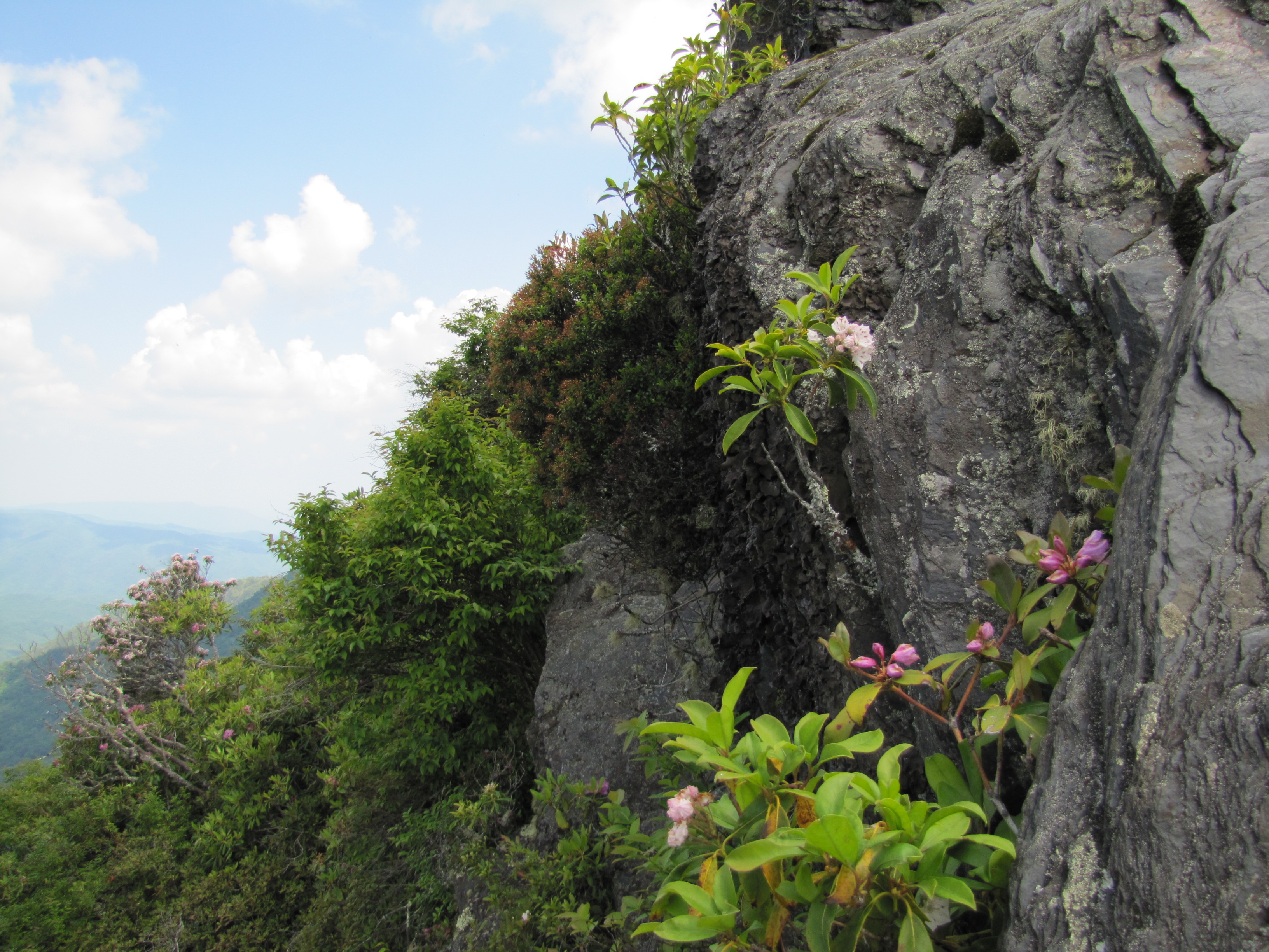
Chimney Tops is one of the few mountains in the Smokies with a bare rock summit. From its 4800-foot summit, Mt. LeConte and Mt. Kephart will dominate the views towards the east, while Sugarland Mountain dominates the view to the west. On a clear day the Sugarlands Valley will be visible towards the north.
Midlife Hikers Review
As always this hike brings some high adventure in the Smoky’s! The hike is considered strenuous and will fight you all the way to the top. I recommend that you prepare for 1 hour per mile or two hours up and one hour down. Your day hike will last at least 4 hours.
The summit of this hike will not disappoint you. There are a couple of ways to get to the very top of this backbone. You can climb straight up the front side or take a little easier path up the backside (closed as of our hike date for rehab). Please please use caution as this part of the hike is extremely dangerous and can take your life. You can get all the views from the lower level of this summit. If you are feeling adventurous then please take your time, plan your footholds and pay attention every step of the way.
Snake Stepper and Go Girl stayed at a safe distance on the lower summit. SoB and Bug Whisperer went halfway to the top. Bug Whisperer took the back trail to the summit but the last foothold was gone, so never made it fully.
I would recommend this hike to the average hiker, as long as you bring plenty of water, snacks and your trail legs. Take your time and enjoy to scenery!