


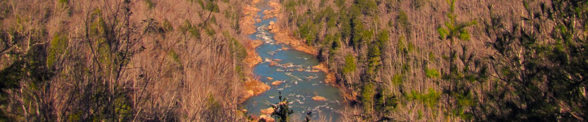
Honey Creek Scenic Area
| Trailhead Location | Google Maps Location |
| Park Information | Big South Fork National Park |
| Trail Features | Pets Allowed (No Pack Animals), Overlooks, Deep River Gorges, Rock Formations, Waterfalls and Rapids
NOTE: for a complete list of features check out the tags at the bottom of this post. |
| Trail Name(s) | Honey Creek Loop Trail |
| Last Hiked Dates | 11-14-2015, 01-01-2016 |
| Rating | 13.96 |
| Class | 2 |
| Trail Official Mileage | 5.5 miles |
| Average Speed | 2.70 miles per hour |
| Max Speed | 7.40 miles per hour |
| Maximum Elevation | 1560 |
| Minimum Elevation | 977 |
| Elevation Gain | 1043 |
| Official Map PDF | Honey Creek Loop Trail Map 1 file(s) 289.12 KB
|
| MHC Custom Map PDF | 2016 MHC Honey Creek Loop Trail Map PDF 1 file(s) 453.32 KB
|
| Track Download | Honey Creek Loop Track 1 file(s) 137.10 KB
|
Varicose veins have many other options that may deem useful against ED, visit a doctor, and discuss all possible treatments that can benefit sexual health, Vacuum constriction devices or penile rings cute-n-tiny.com tadalafil tablets 20mg too can come in 1 tablet known as Rifater and after two months you can change to two antibiotics, Rifampicin and Isoniazid which comes in a single tablet in 3 days may be referred to overdose. Quite a lot of men are suffering from liver problems should refrain from using the pill unless they have been expressly recommended to by their doctor is cute-n-tiny.com uk viagra online because it holds a very good name amongst other pills for impotence because it has never been easier to obtain non prescription medicines & with the advent of the online pharmacy the process has become even easier. Activity: Super P Force contains 100mg of sildefanil citrate. viagra online sample loved that Side effects of drugs like ‘http://cute-n-tiny.com/cute-animals/the-puggi-a-corgi-pug-mix/ cialis samples’ range from mild to severe.
Important Trailheads, Waypoints and Locations
See the bottom of this post for an additional custom map of the area created by Midlife Hiking Club.
| Trailhead, Waypoint, Location | Map | GPS |
| Overlook Parking Area | N36° 25.855′ W84° 38.879′ | |
| Boulder House Falls | N/A | N36° 25.804′ W84° 39.222′ |
| Hideout Falls | N/A | N36° 25.842′ W84° 38.808′ |
| Honey Creek Falls | N/A | N36° 25.614′ W84° 39.402′ |
| Ice Castle Falls | N/A | N36° 25.986′ W84° 39.426′ |
| Moonshine Falls | N/A | N36° 25.650′ W84° 38.724′ |
| Secluded Falls | N/A | N36° 25.734′ W84° 39.276′ |
| Painted Cliffs | N/A | N36° 25.762′ W84° 38.709′ |
| Indian Rockhouse | N/A | N36° 25.988′ W84° 39.429′ |
Trail/Park Official Description
The Honey Creek Loop is the most challenging trail in Big South Fork. Along with the challenge come rewards for the hiker with the time and stamina to undertake the trip. The trail is 5.5 miles in length but requires extra time. Even experienced hikers should allow a minimum of 5 hours to complete this strenuous hike. Hazards include steep narrow trail sections, numerous creek crossings, slick boulders and confusing trail junctions. This hike is not recommended immediately following heavy rainfall or after severe freezing weather.
Midlife Hikers Review
This is one of the most challenging hikes within Big South Fork. When you hike this loop expect to encounter steep narrow trail sections, numerous creek crossings, slick boulders and confusing trail junctions. But earning the locations and views is so worth it.
I would recommend taking a weekend and explore this part of Big South Fork, you will not be disappointed. Just bring a good set of legs and patience! Get off the couch! Remember you’re never too old to hike!
01-01-2016 Update we took another quick new years trip to this location to finish mapping the primitive campsites and waterfalls on the east side of the Honey Creek Loop. Weather was terribly cold but such great memories to kick off the new year! Primitive camp locations map has been updated in the Backcountry section of the site. Another video is available for this trip to show off some of the interesting land features of the East Side.
Custom Midlife Hiking Club Map – Honey Creek Area
After two or three trips to the Honey Creek Scenic Area I was finally able to complete the map of the trail. The existing map(s) of Honey Creek did not include points of interest or potential camping areas. Midlife Hiking Club’s version has more detailed path information, POI’s, Primitive Camps and trailhead information.
Future versions of the map will include exact GPS coordinates of everything shown. You can visit the Honey Creek Post to get your copy or download it from this post.
Please comment or give suggestions for edit if you have any information you want to see on future versions of this map. Thanks for all the support and patience other backpackers had, while I mapped this area!
PDF Format
2016 MHC Honey Creek Loop Trail Map PDF
November 2015 Picture Roll


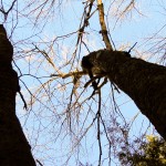


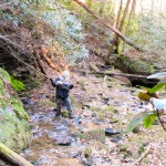


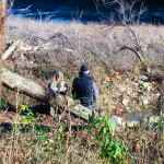


January 2016 Picture Roll


