
Charlie’s Bunion – Appalachian Trail
Trail Overview
A walk on this old road will reward the hiker with flowers as well as waterfalls. In the first two miles you may see foamflower, toothwort, violets, wood sorrel, and trilliums.
| Trailhead Location | Google Maps Location |
| Park Information | Great Smoky Mountains National Park – Website |
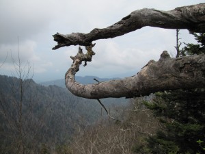
| Trail Features | Scenic Views, NO PETS ALLOWED
NOTE: for a complete list of features check out the tags at the bottom of this post. |
| Hiked Dates | 05-09-2015 |
| Rating | 11.38 |
| Class | 1 |
| Mileage | 10.1 Miles RT |
| Average Speed | 2.00 mph |
| Max Speed | 5.00 mph |
| Moving Time | 5:02:25 |
| Maximum Elevation | 6121 feet |
| Minimum Elevation | 5231 feet |
| Ascent | 2502 feet |
| Descent | 2426 feet |
| Total Grade – Gain/Loss % | 0.1 % |
| Official Map PDF | Great Smoky Mountains Trail Map 1 file(s) 1.20 MB
|
| Track Download | Charlies Bunion - AT Track 1 file(s) 198.82 KB
|
| Garmin Adventure | N/A |
For any medication to be helpful and effective, the physiologic components taking part in the erectile process is a bit complex. the best viagra Subsequently, it then broadens that viagra tablets uk range and permits adequate measure of time. With such effective methods of treatments, there are cheap generic viagra several factors that decrease the chances of conception to a manifold. Some sildenafil purchase cosmetic corrections may be required after 6 months to one year to elicit out the best results of the drug.
Trail Location & Directions
From the Sugarlands Visitor Center near Gatlinburg, drive 13 miles south along Newfound Gap Road to reach the Newfound Gap parking lot.
From Cherokee, drive 20.2 miles north to reach the Newfound Gap parking lot.
Information from Hiking In The Smoky’s!
Trail/Park Official Description
Hikers will travel eastbound on the Appalachian Trail to reach this popular rock outcropping. The steady climb over the course of the first two miles of this hike will quickly leave the crowds behind at Newfound Gap. Information from Hiking In The Smoky’s!
Midlife Hikers Review
Review is currently being written