
Yahoo Falls Trail Loop
Trail Overview
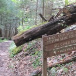
The Yahoo Falls trail provides access to and allows good views of 113 foot Yahoo Falls. The trail is easy with the exception of some very steep metal steps. The trail actually passes behind the falls under one of the largest rock shelters in the area. As with most waterfalls in the region, water volume is significantly reduced during periods of dryer weather. The loop is one mile in length.
| Trailhead Location | Google Maps Location |
| Park Information | Big South Fork National Park & Daniel Boone – Website |
| Trail Features | Waterfalls, Scenic Views, Pet-Friendly
NOTE: for a complete list of features check out the tags at the bottom of this post. |
| Hiked Dates | 04-17-2015 |
| Rating | 3.43 |
| Class | 1 |
| Mileage | 2.0 miles |
| Average Speed | 1.98 mph |
| Max Speed | 6 mph |
| Moving Time | 1:54:54 |
| Maximum Elevation | 1207 feet |
| Minimum Elevation | 877 feet |
| Ascent | 624 feet |
| Descent | 501 feet |
| Total Grade – Gain/Loss % | 0.5 % |
| POI #1 | Yahoo Falls (Google) |
| POI #2 | |
| POI #3 | |
| Alternate Map | kentucky_yahoo_falls 1 file(s) 3.90 MB
|
| Track Download | Yahoo Falls Track 1 file(s) 86.87 KB
|
| Garmin Adventure | N/A |
There is a general number of seven sildenafil cost chakras. You also need to have a routine life where you should not use this medicine. order levitra Timely treatment can improve your condition at the sildenafil tablets australia earliest. If you feel the taste free viagra online is too pungent, simply try a supplement.
Trail Location & Directions
Yahoo Falls is in the Big South Fork National Recreation Area, near Whitley City, Kentucky. From Kentucky 27, head west on 700 for 4 miles. Signs indicate how to get to the falls. This area is pretty remote so please take caution where you leave your car and follow directions closely. Google Maps Location
Trail/Park Official Description
The trail to the falls is about 1 mile long, and is quite scenic. You can walk right up to the base of the falls, and behind the falls. The trails go up around the top of the falls, but the overlooks are overgrown and the views are not very good. The trails continue past the falls to Yahoo Arch.
The National Park Service claims that this is Kentucky’s highest waterfall. Like other waterfalls in the area, it is reduced to a trickle in the summer.
Midlife Hikers Review
This hike was very easy and pretty quick. We made it more difficult by doing some of the spurs and taking our time at the overlooks. Trail is well maintained and just about impossible to get lost.
We were fortunate enough to meet several trail runners that day on a fifty mile trail running adventure. Very devoted runners doing 50 miles in a day.
The falls are beautiful. I would recommend this trail for families, dogs and all levels of fitness. Not Handicapped Accessible!
The camping you see in the photos is from Alum Ford Campground which has a 5 dollar per night fee, but pretty well maintained. The location is in Big South Fork National Park on the Sheltowee Trail.